My father said this during a conversation we had over one of my maps (see more on map conversation here). This was said in relation to Malta's usefulness to the rest of the world - its strategic position at the centre of the Mediterranean. He referred to the Freeport as another example of this: a large slab of concrete on which to keep containers for transhipment, before that during WW2 it was an aircraft carrier strategically positioned between Italy and North Africa, before that a port,...
Winston Churchill called Malta the "unsinkable aircraft carrier" - perhaps this is more positive than my father's comment - since this elevates the island slightly higher than an average aircraft carrier? (Malta played a significant part in WWII and was one of the most intensively-bombed areas during the war. The German Air Force and the Italian Royal Air Force flew a total of 3,000 bombing raids over a period of two years.)
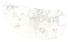
I put this image together, another play on scale, perception and identity - is this how Malta looked to its colonisers?